
LAS VEGAS SUN
A backyard in Henderson is illuminated by lightning amid a thunderstorm late Thursday, Oct. 11, 2012. Hail was reported in various parts of Henderson; its accumulation is seen on the grass.
Published Thursday, Oct. 11, 2012 | 7:03 a.m.
Updated Thursday, Oct. 11, 2012 | 10:49 p.m.
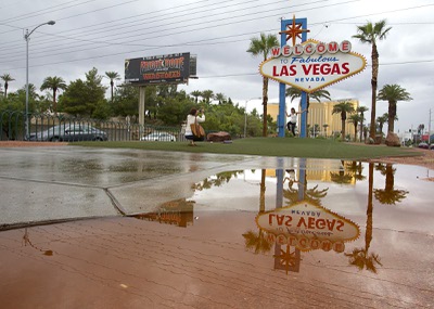
The "Welcome to Las Vegas" sign is reflected in a rain puddle as Amanda Thompson photographs her sister Melinda Casey Thursday, Oct. 11, 2012. Thompson is living in England and Casey is from Australia so they decided to meet halfway for a Vegas vacation, they said.
Sun weather coverage
Showers and thunderstorms moving Thursday through the Las Vegas Valley prompted the National Weather Service to issue several flash flood warnings for the central and western portion of the county.
Around 7:55 p.m. the National Weather Service issued a flash flood warning for central Clark County as thunderstorms rolled through the Las Vegas and Henderson areas that could bring up to half an inch of rain. Dime-sized hail also fell in parts of Henderson. The warning is set to expire at 12:45 a.m.
The valley has been drenched in precipitation throughout the day. An earlier flood advisory for central Clark County expired at 4:15 p.m.
A flash flood warning means flash flooding has been detected by radar or observed by trained storm spotters, and people in the warning area should take proper protective measures. A flash flood advisory is issued when heavy rain may cause flooding of streets and low-lying places.
“We had numerous showers and thunderstorms over the west side of the valley from 9 p.m. to 3 a.m., and then another batch between 5 a.m. and 6 a.m.,” said Jim Harrison, a meteorologist for the National Weather Service.
Harrison said rainfall ranged mostly from a quarter to a half inch on the west side of the valley, with one gauge northwest of the city picking up more than three-quarters of an inch of rain.
Showers were generally lighter overnight across the east side of the valley, he said.
By 6 a.m., McCarran International Airport had received about .4 of an inch of rain overnight. Henderson Executive Airport had .23 of an inch, and the North Las Vegas Airport had recorded .56 of an inch.
Showers and isolated thunderstorms moving through the valley through Thursday night are expected to bring between another .25 of an inch to .5 of an inch of rain, although some areas could get more than an inch, Harrison said.
Temperatures are expected to be dramatically cooler Thursday and Friday, with highs climbing only into the upper 70s, which is 10 to 15 degrees below normal, he said.
The showers and thunderstorms are also expected to bring the first high-elevation snow of the season.
Snow is expected to fall in the Mount Charleston area below 8,900 feet Thursday night, lowering to 8,200 feet after midnight. Little or no accumulation is expected, according to the weather service.
Temperatures in the Mount Charleston area are expected to drop to 36 degrees early Friday morning and to 33 degrees early Saturday.
Join the Discussion:
Check this out for a full explanation of our conversion to the LiveFyre commenting system and instructions on how to sign up for an account.
Full comments policy