AP Photo/Marcio Jose Sanchez
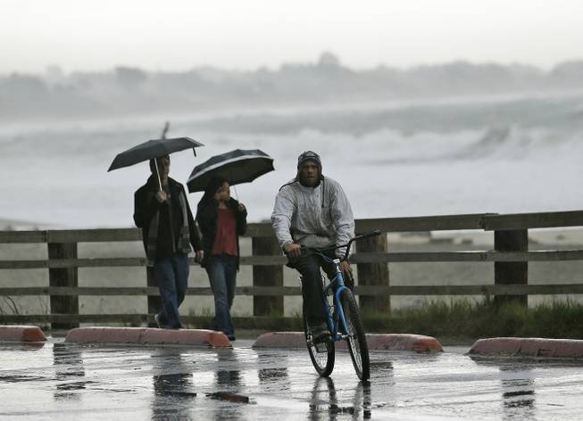
Visitors shield themselves from the rain along the beach at Seacliff State Beach Friday, Feb. 6, 2015, in Aptos, Calif.
Published Friday, Feb. 6, 2015 | 9:40 p.m.
Updated Saturday, Feb. 7, 2015 | 10:18 a.m.
SAN FRANCISCO — Northern California got a break Saturday from a wet and windy storm that downed trees and power lines, ripped through freeway and street signs and led to dozens of flight cancellations at San Francisco's airport.
But that break was expected to be short-lived, as another storm system barreled toward the region with more rain and wind.
The sun peeked through the clouds on Saturday in San Francisco, where scattered showers were expected throughout the day. The next storm system was forecast to hit on Sunday morning, bringing wind gusts as high as 45 mph and up to 3 inches of additional rain on coastal hills in the San Francisco Bay Area and another 1.5 inches on Bay Area cities.
"The winds will be up again, especially along the coast," said Austin Cross, a forecaster with the National Weather Service.
The storm system was expected to affect much of the West Coast, with a flood warning in effect for parts of Oregon and the threat of landslides in western Washington.
The rains will persist into the weekend, and weather officials warn of flooding in several rivers in western Washington.
In the Bay Area, more than 60,000 people lost power, as winds from Friday's storm brought down trees that took out power lines. By Friday evening, 9,000 customers remained without power, Pacific Gas & Electric said.
North of San Francisco, businesses in Marin, Napa, Solano, and Sonoma counties stacked sandbags to prepare for possible flash flooding from swollen waterways, but there were no reports of any significant damage.
San Francisco International Airport saw delays of up to 90 minutes and about 175 flights canceled Friday, and some arriving flights continued to experience delays of up to 45 minutes on Saturday morning.
San Francisco got about three-quarters of an inch of rain while some coastal communities in the Bay Area saw more than five inches — a welcome change after six dry weeks in the Bay Area.
The storm was far from a drought-buster, however, particularly as it stayed warm and didn't bring much snow to the Sierra. Snow is more important than rain because snowpack supplies about a third of the water needed by residents, agriculture and industry.
The storm dropped between 10 to 15 inches of snow at higher elevations of the Northern Sierra, National Weather Service forecaster Holly Osborne said. The next system was also expected to be warm, bringing as much as another 14 inches of snow before moving out Monday.
Associated Press writers Doug Esser in Seattle and Scott Sonner in Reno contributed to this report.

Join the Discussion:
Check this out for a full explanation of our conversion to the LiveFyre commenting system and instructions on how to sign up for an account.
Full comments policy