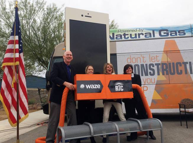
Clark County Commissioner Larry Brown, from left, Waze’s Paige Fitzgerald, Regional Transportation Commission General Manager Tina Quigley and Las Vegas City Manager Betsy Fretwell mark the launch of a partnership between the RTC and real-time traffic app Waze.
Saturday, April 9, 2016 | 2 a.m.
As Las Vegas braces for $1 billion in road construction, the Regional Transportation Commission of Southern Nevada is working with Waze, the popular real-time traffic app, to share information with the public.
RTC launched the partnership with Waze a day after the kickoff of Project Neon, which over time should reduce traffic around the Spaghetti Bowl but will cause delays during three years of construction.
Under the partnership, the RTC, Southern Nevada’s transit authority, will feed the Waze app with data so that drivers can access up-to-date information on road construction, traffic accidents and road closures.
“Orange cones are a part of our lives right now,” Tina Quigley, the authority’s general manager, said during remarks at a news event Friday.
And Project Neon is not the only source of those cones. The RTC estimates there are about 75 construction projects in the region.
Waze aggregates traffic information, like speed, from the phones of its users, who keep the app open while they drive. Using that, it recommends the most efficient route to get from Point A to Point B. Users can also report obstructions like accidents and hazards. The RTC is working with Waze’s Connected Citizens Program, which allows organizations to funnel additional sources of information into the platform. The program’s partners include large metro areas like Los Angeles and Washington, D.C.
Partnering with Waze has benefits for the RTC as well, Quigley said. The company plans to share its incident response data with the transit authority, which will allow it to better understand traffic patterns.
“We believe traffic is a universal problem but that we are all in it together,” said Paige Fitzgerald, Connected Citizens program manager.
The partnership with Waze coincides with a broader RTC effort, dubbed the Seeing Orange campaign, to provide more traffic updates. Seeing Orange’s website offers a regional map of all projects with updates and a form to submit comments.

Join the Discussion:
Check this out for a full explanation of our conversion to the LiveFyre commenting system and instructions on how to sign up for an account.
Full comments policy