
Sunday, July 31, 2016 | 3:57 p.m.
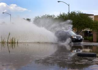
Rain hit the valley again Sunday afternoon as the National Weather Service issued a severe thunderstorm warning for the west Las Vegas Valley.
The weather service tweeted about 3:15 p.m. that areas including Summerlin are forecasted to receive heavy rain, winds up to 60 mph and hail. Southeast areas, including Henderson, are also expected to receive heavy rain throughout the day.
There is a 30 percent chance of rain throughout the rest of the valley, meteorologist John Salmen said.
A flash flood warning also was issued by the National Weather Service for Sheep Range, a mountain range north of Las Vegas that crosses into both Clark and Lincoln counties in the Desert National Wildlife Refuge, where there is a 50 to 60 percent chance of showers.
There may be an increase of dust in the air as thunderstorms pick up dust off dry lake beds in the south valley, Salmen said. Winds are forecasted to be 10 to 20 mph in most areas.
Today’s high is 105 degrees. The low for Monday is 85 degrees, with a high of 103 degrees, Salmen said.
Join the Discussion:
Check this out for a full explanation of our conversion to the LiveFyre commenting system and instructions on how to sign up for an account.
Full comments policy