Tony Carmean / Aerial MOB LLC / AP
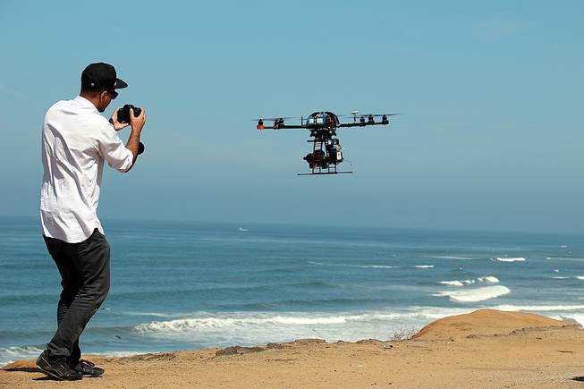
This image shows the eight-rotor Sky Jib Helicopter in San Diego, Calif., in August 2013.
Friday, Aug. 7, 2015 | 4:22 p.m.
Researchers at UNR are collaborating with NASA and two drone companies to test an air traffic control system for low-flying unmanned aircraft.
Later this month, a university team will be one of 12 groups testing software that lets drones communicate with the system NASA is developing. The test will take place at the space agency’s Crows Landing Airport in California.
The collaboration is part of a research project out of NASA’s California-based Ames Research Center to speed along the creation of an air traffic control system for fast-flying manned and unmanned aircraft — gliders, helicopters, planes and drones — that often operate at altitudes of 500 feet and below.
UNR is the first to create software for drones to communicate with NASA’s system.
“With all of the many uses being developed for unmanned aerial systems, air traffic nearer to the ground has the potential to become very crowded,” said Warren Rapp, business director for UNR’s Nevada Advanced Autonomous Systems Innovation Center. “We’re pleased to be part of this leading-edge, forward-thinking project.”
NASA’s effort comes as the FAA has promised to integrate commercial drones into the national airspace.
The goal of the project is to provide a system for the FAA to use, said Richard Kelley, chief engineer for the UNR innovation center.
The university, which wrote the code that allows its test drone to communicate with NASA’s system, will test the plane with Flirtey, a company that conducted the first FAA-approved delivery via drone in July, and Drone America, a Reno-based firm that operates and manufactures unmanned aircraft hardware.
Kelley said UNR’s software allows for the transmission of aircraft information, such as location, position and heading, to NASA’s control system, which considers variables such as temporary flight restrictions and the location of other aircraft.
The system could eventually allow drone operators and others to see information about airspace operations in nearby areas.
“There has to be a way to figure out where all the drones are,” Kelley said.
This month’s test is the first phase in what is expected to be a three- to five-year process of perfecting the system. During the first phase of testing, the agency’s partners will record data and look for any glitches.

Join the Discussion:
Check this out for a full explanation of our conversion to the LiveFyre commenting system and instructions on how to sign up for an account.
Full comments policy