Nico Ramirez/National Park Service via AP
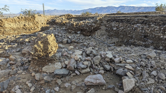
This undated photo released by the National Park Service shows California State Route 190 (SR 190) missing shoulders and undercut in several areas in Death Valley National Park, Calif., after Tropical Storm Hilary dropped more than 2 inches of rain on the park in August.
Monday, March 18, 2024 | 2:37 p.m.
An additional 382 miles of roads in Death Valley National Park damaged by Hurricane Hilary in August have reopened, the National Park Service announced today.
Still, about 250 miles of park-maintained roads remain closed, the park service said.
“While there is still more to do, it is important we let people know that their park has just become a bit more accessible,” said Mike Reynolds, the park superintendent.
In the six months since the hurricane, Death Valley has received 4.9 inches of rain, more than double the annual average of 2.2 inches.
The past six months have featured environmental and archeological assessments, emergency repairs and other cleanup to get damaged areas open for the public to visit, the park service said.
The areas opened this week include:
•South Crater Mine, Crater Mine Spurs, Little Sand Springs and Cowhorn Valley in the northeast and northwestern reaches of the park.
•South Park Road and South Park Cutoff — roads the service recommends for use with four-wheel drive vehicles.
•Rogers Pass Road, Middle Park Road Bypass and Rita’s Cabin Road.
•Virgin Spring Road and Upper Confidence Wash Road at the southern end of the park. Both roads require four-wheel drive vehicles.
Another 195 miles of roads were opened March 9.
The park service will spend the next two months working on reopening the remaining closed areas, which span about 250 miles, officials said.
Titus Canyon and Salt Creek roads had extensive damage and will be closed much longer, officials said.
