Wednesday, Oct. 25, 2023 | 2 a.m.
The National Oceanic and Atmospheric Administration is predicting higher-than-usual rainfall for parts of Nevada, California and Arizona this winter, but that rainfall isn’t expected to translate to gains in the water level at Lake Mead, regional climate experts said.
El Niño’s southern oscillation cycle began changing weather patterns this month and will continue through the winter to bring wetter conditions to the southern United States, said Jon Gottschalck, the operational prediction branch chief for the National Oceanic and Atmospheric Administration (NOAA).
There’s a 75% to 85% chance of a strong El Niño this winter, making it the dominant factor determining the U.S. winter climate, Gottschalck said at a news conference last week detailing the winter outlook. Gottschalck also said warmer-than-average conditions were expected in Alaska, the Pacific Northwest and parts of New England.
El Niño is “a warming of the ocean surface, or above-average sea surface temperatures, in the central and eastern tropical Pacific Ocean,” according to the United States Geological Survey. The weather phenomenon last occurred in 2019 after three consecutive years of La Niña, which takes place when those surface temperatures are cooler than average.
The effects
El Niño is expected to bring a milder winter to the northern U.S. — from the Pacific Northwest and Alaska to the Rockies, Plains and Midwest. However, individual storms will still bring heavy snowstorms to those areas — just less frequent than a normal winter, according to the NOAA outlook which covers the months of December, January and February.
El Niño conditions typically have brought more winter and spring precipitation to the desert Southwest, but the impact on the Colorado River Basin is expected to be “all over the place,” according to Paul Miller, service coordination hydrologist for the NOAA Colorado Basin River Forecast Center.
Atmospheric circulations driven by El Niño typically bring more precipitation to Southern California, Northern Arizona and Southern Nevada, Miller said, but that won’t translate into higher lake levels because the vast majority of Lake Mead’s water comes from melted mountain snowpack released from Glen Canyon Dam and Lake Powell. That snowpack originates in the higher elevations of Colorado and Utah and the southern part of Wyoming, and El Niño doesn’t typically make a difference in the snowfall in those areas.
“It really remains to be seen in our area.” Miller said. “We’ve had some really strong El Niño years that have not been very wet or very warm, and we’ve had some strong La Niña years that have been very wet and cooler.”
The Oceanic Niño Index tracks water surface temperatures in the east-central tropical Pacific Ocean to predict the strength of each El Niño event. The forecast center compiled figures showing past El Niño strengths and the corresponding amounts of runoff Lake Powell received during the summer. Those compilations show little to no correlation.
“We’ve seen years that have very high index values and very low runoff, and we’ve had years with low index values,” Miller said. “There’s not really a strong correlation in our area with snowpack or runoff.”
Miller said the additional rainfall might help reduce the amount of water going to agriculture in Southern Nevada, Southern California and Northern Arizona, which could lessen demand on Lake Mead and give the reservoir a small boost in a roundabout way.
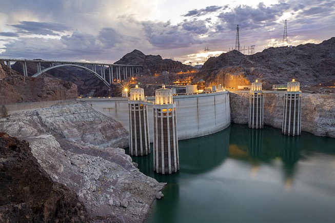
A two-decade drought is leaving less water flowing through the Colorado River and its tributaries, resulting in depleted reservoirs that store the water that allows the West to thrive. Those reservoirs — Lake Powell and Lake Mead — are still only about 37% and 34% full, respectively, as of Sunday, according to a weekly water supply report from the Bureau of Reclamation.
Miller isn’t the only regional expert who recommends taking the three-month forecasts with a grain of salt.
Daniel McEvoy, a regional climatologist with the Western Regional Climate Center, said El Niño years were unpredictable in the West, and there was no guarantee the weather pattern would bring more moisture than usual over winter and spring.
“The November-through-January outlook shows very little signal. It shows equal chances of above- or below-average precipitation for the whole Colorado River Basin,” McEvoy said.
He said the outlook from December to February showed a chance of higher-than-usual precipitation, but those were still modest odds.
rhiannon.saegert@gmg vegas.com / 702-948-7836 / @Missmusetta

